
First Point Surveys Ltd
Land Surveying Activities in Knaresborough
2 Stoneacre, Grimbald Crag Close
Knaresborough
North Yorkshire
HG5 8PJ
Contact Numbers
Telephone: 0776 73... 0776 7307620
Websites
Social
About
- Topographical Surveys
- Measured Building Surveys
- Underground Utility Surveys
- Land Registry Complaint Plans
- Ground Penetrating Radar (GPR)
- Floor Plans
- Building Elevations
- Boundary Determinations
About Us
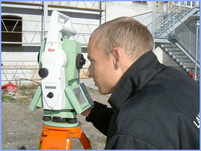
We are a leading Land, Building and Underground Utility Surveying Company based in Harrogate, North Yorkshire providing Topographical, Measured Building & Utility Surveys across the UK, Europe and the Middle East. We use the fastest and most accurate GPS (GNSS), total stations, ground penetrating radar (GPR) and electromagnetic locators (EML) to supply floor plans, building elevations, topographical and underground utility surveys in a variety of CAD and other electronic formats.
First Point Surveys
We are a Yorkshire based independent company of surveyors specialising in: Topographic Surveys (Land), Measured Building Surveys (Floor-plans), Elevations (Architectural), Monitoring/Deformation, Underground Utility Surveys (GPR & EML), Volumations (Quarries, Muck-Shift, Land-Fill).
With offices centrally located in Harrogate & Knaresborough we are ideally positioned to carry-out surveys throughout the UK and beyond.
Clients
Our clients, whilst usually architects, house builders, engineering companies and developers, range from individuals wishing to extend or re-fit an existing dwelling right up to large, multi-national companies involved in public/private funded initiatives.
We can survey a small area of your house/garden or every detail of a city hospital or school.
Quotations
To enable us to tender for a survey we usually require some kind of site plan.
If it's a land (Topographical) survey you require you can draw the area you wish surveyed onto a copy of your deeds or an Ordnance Survey site plan, including details of any special requirements.
If you require elevations or floor plans we usually ask for some photos of the building as well as a site location plan.
As always our quotations are free and carry no obligation.
Specialist Services
We are leaders in the surveying field. Topographic, Underground Utility and Measured Building Surveys are our specialty
Trade Bodies / Associations
Chartered Institution of Civil Engineering Surveyors (ICES), The Chartered Institute of Building (CIOB).
Trading Since
2006
Reviews
There are currently no reviews for this company
Leave your review of First Point Surveys Ltd
All fields are required. Your review will appear immediately.


Products and Services
Topographical Survey
Land survey to measure all above ground features including levels
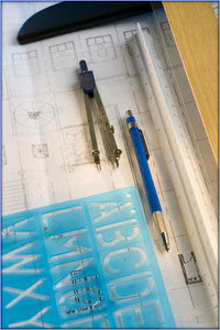
Floor Plans
Measured building floor plans showing walls, windows, doors, beams, stairs, etc. including levels and heights
Architectural Building Elevations
Measured building facades including ground level, doors, windows, cills, lintels, facades, ridge, eaves, chimneys, roof windows, vents, fenestration, coursing, etc. including heights / levels
Laser Scanning
3D laser scanning for various measured survey works
Underground Utility Surveys
Location and mapping of underground utility supplies including telecoms, water, gas, electric and drainage
Boundary Determinations
Mapping services to aid boundary location where disputed or unknown
Drone Surveys
Mapping services using drones
We offer these services
- Free Parking
- website
- Price Match
- Free Quotes
- Customer Toilets
We offer these payment methods
- Cheque
- Bank Transfer