Hawkeye Aerial cameras
Aerial Photographers & Surveys in Maidstone
2, St. Marys Close
Laddingford
Laddingford
Maidstone
Kent
ME18 6DG
Contact Numbers
Social
Key Services
About
- Mast Photography
- Aerial Imagery
Commercial, Industrial, Residential and Environmental Photography - Aerial Photography - Elevated Mast (24m) Photography, Video & CCTV Surveys - High Level 3D Lazer Scanning & Thermal Imaging - Tracing of Historical Aerial images for Boundary & Curtilage Disputes / Adverse Possession claims / Land Grabs / Rights of Light issues / Insurance Claims / Evidence of Previous Land or Building use
Specialist Services
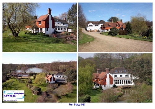
Mast Photography to 24m - Roof Surveys, Structure perpendicular views, Visualisation backdrop imagery, Site progress and property sales - too many uses to list here + Aerial Photography by Aircraft across the UK - For larger sites onshore/offshore
Aerial Photography + Elevated Mast Photography, Video, CCTV Surveys - Home
Aerial Photography, Ground Level, Elevated Mast Photography, Video and CCTV surveysHistorical Aerial Photographs - Boundary Disputes, Rights of Light, Planning Applications & Appeals, Evidence of previous land use
Aerial Photography + Elevated Mast Photography, Video, CCTV Surveys - Home
Specialists in:
- Aerial Photography by Aircraft
- High Level Mast: Photography, Video & CCTV surveys
- High level Thermal Imaging & 3D Laser Scanning
- Site Surveys, Time lapse Commercial, Marketing, Construction, Environmental, Remediation, Brownfield site Evidential, Eco-Builds & Solar Energy arrays, Architectural Backdrop Visualisations
- Historical Aerial Image Tracing service - from over 250+ UK & International sources (1920's - present day) - Boundary Disputes, Rights of Light / Planning Applications / Appeals & Evidence of Previous Land / Building use - All can be supplemented by current day Aerial images.
Our New 'High Level Mast' Laser scanning and Passive Thermal Imaging Survey Services - are now up and running as at March '12
' Visual Solutions - New Perspectives '
Kent based Aircraft based Aerial Photographer & 24m Mast Photography/Video/Mobile CCTV, recently adding associates for High level Thermal Imaging/3D Laser Scanning.
Specialising in Environmental Photography
Established 1996.
Photo Library.
Coverage - mainly SE UK.
Trading Since
1996
Reviews
There are currently no reviews for this company
Leave your review of Hawkeye Aerial cameras
All fields are required. Your review will appear immediately.

Offers
Imagery from where UAV's cannot fly
Capturing Hi-Level & Aerial Imagery in the Urban and Rural Environment - Quickly, Quietly, Safely and Cost Effectively ......where UAV's cannot (legally or easily) fly. Hi-Level 24m mast for Thermal Imaging, InfraRed, CCTV, LoS (Line of Sight Markers & Spotlights), CCTV, Photography, Video, Flag Markers - Aerial Photography from Aircraft - Tracing of Historical Aerial Imagery for Legal & Insurance Claims, Boundary Disputes, Rights of Light, - Hi-level Buildings surveys and roof inspections in London, major Cities & Towns (where UAV's are not permitted to fly ( legally or easily) - but we do also offer a UAV service with our associates.
Terms: Specialising in High level Building surveys in London, Towns
Expires: 01/08/2025